Key Historical Maps of Lithuania
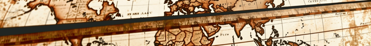
Maps have always been powerful tools to understand the world, offering insights into geographical, cultural, and political contexts of different eras. Lithuania, a nation with a rich and complex history, is no exception. Its cartographic journey parallels the country's evolution through centuries, reflecting the influence of neighboring cultures, the prominence of the Grand Duchy of Lithuania, and the challenges of partition and independence. This article delves into the key historical maps of Lithuania, exploring how they have shaped and been shaped by the nation's past.
From the early cartographic representations that provided the first glimpses into the region's landscape, to the detailed maps created during the height of the Grand Duchy's power, these documents reveal much about Lithuania's role in European history. The interplay of cultures and politics is vividly depicted in these maps, serving as both historical records and artistic expressions. Each map not only tells a story of territorial boundaries and strategic interests but also of cultural exchanges and influences.
As we move into the modern era, the significance of these historical maps continues to grow. They serve as educational tools and cultural treasures, offering a window into the past while informing contemporary geographic studies. Advances in technology have further enhanced our ability to preserve and interpret these maps, ensuring that they remain an integral part of Lithuania's cultural heritage. Join us as we navigate the intricate and fascinating world of Lithuanian cartography, from its earliest depictions to its modern-day interpretations.
The Evolution of Lithuanian Cartography
The history of Lithuanian cartography is a fascinating journey that reflects the cultural, political, and technological changes the region has undergone over the centuries. From the early representations of the Lithuanian landscape to the influence of neighboring cultures and the significant impact of the Grand Duchy of Lithuania, maps have served as valuable tools in understanding the evolution of this region. This section delves into the key phases and influences that have shaped Lithuanian cartography throughout history.
Early Cartographic Representations
In the earliest days, cartography in Lithuania was primarily rudimentary, with maps being more symbolic than precise. These early maps were often drawn by navigators and explorers who sought to chart the unknown territories of Eastern Europe. The primary focus was on major geographical features such as rivers, forests, and settlements, which were depicted to aid in navigation and exploration. Such maps were often created on animal skins or parchment and were not intended for widespread distribution but rather for personal or local use.
During this period, cartographers relied heavily on oral accounts and the limited written records available. Consequently, these maps often contained inaccuracies and were subject to the interpretations and biases of their creators. Despite these limitations, early cartographic efforts laid the groundwork for more sophisticated mapping techniques in the future.
Influence of Neighboring Cultures
The development of Lithuanian cartography was significantly influenced by the cultures and powers surrounding it. As a region situated at the crossroads of major European civilizations, Lithuania was exposed to various cartographic traditions and techniques from neighboring countries. The influence of German, Polish, and Russian cartographers is particularly notable in the evolution of Lithuanian maps.
German cartographers, renowned for their precision and detail, played a crucial role in introducing more accurate mapping techniques to Lithuania. Their influence is evident in the increased use of scale and projection methods, which improved the accuracy of maps. Polish cartographers contributed to the expansion of the cartographic knowledge base in Lithuania by sharing their expertise and resources, leading to more comprehensive maps of the region.
The Russian Empire's presence in Lithuania also left a lasting impact on its cartographic practices. Russian cartographers brought with them advanced surveying techniques and mapping technologies, which were adopted by Lithuanian mapmakers. This exchange of knowledge and skills helped to further refine the quality and accuracy of Lithuanian maps.
The Impact of the Grand Duchy of Lithuania
The Grand Duchy of Lithuania, which existed from the 13th to the late 18th century, was a significant political and cultural entity in Europe, and its influence on Lithuanian cartography was profound. As one of the largest and most powerful states in Europe during its time, the Grand Duchy required detailed and accurate maps for administrative and military purposes.
The establishment of the Grand Duchy led to a heightened demand for cartographic works that could effectively represent its vast territories. This period saw the creation of more detailed and comprehensive maps, which were used for governance, taxation, and defense planning. The Grand Duchy's maps often included detailed depictions of cities, roads, and natural resources, reflecting the need for effective management of the state's resources and infrastructure.
An important aspect of the Grand Duchy's cartography was its emphasis on representing the multicultural and multiethnic nature of the state. Maps from this era often included annotations and place names in multiple languages, reflecting the diverse population that inhabited the region. This inclusive approach to cartography not only provided valuable information for administrative purposes but also contributed to a greater understanding of the cultural landscape of the Grand Duchy.
The legacy of the Grand Duchy of Lithuania's cartographic achievements is still evident today. Many of the maps produced during this period have been preserved in archives and libraries, serving as invaluable resources for historians and researchers studying the region's rich history.
Key Points:- Early Lithuanian maps were symbolic and used for navigation.
- German, Polish, and Russian influences improved mapping techniques.
- The Grand Duchy of Lithuania required detailed maps for administration and defense.
- Multilingual annotations on maps reflected the region's diversity.
In conclusion, the evolution of Lithuanian cartography is a testament to the region's dynamic history and its interactions with neighboring cultures. From the early, symbolic representations to the sophisticated maps produced during the time of the Grand Duchy, Lithuanian cartography has been shaped by a multitude of influences. These maps not only provided practical information for navigation and administration but also captured the cultural and political complexities of the region. As we continue to study these historical maps, they offer valuable insights into the past and help us understand the ever-changing landscape of Lithuania.
Significant Maps and Their Historical Context
The territory of Lithuania, strategically located at the crossroads of major trade routes in Europe, has been subject to numerous historical changes. These transformations have been meticulously documented through maps, which serve as pivotal records of both geographical and political landscapes. Significant maps of Lithuania not only illustrate territorial boundaries but also reflect cultural and social influences over the centuries.
The Carta Marina: Lithuania in the 16th Century
The Carta Marina, created by the Swedish cartographer Olaus Magnus in the early 16th century, is a seminal work that provides one of the earliest detailed depictions of the Baltic Sea region, including Lithuania. Published in 1539, the map is renowned for its intricate and artistic representations of various geographic and cultural features. It serves as a vital historical source for understanding the maritime and coastal features of Lithuania during this period.
Olaus Magnus, who was deeply interested in the cultural and natural aspects of Scandinavia and the surrounding regions, infused his map with rich illustrations, depicting ships, sea monsters, and various regional costumes. Although the map primarily focuses on Scandinavia, its inclusion of Lithuania highlights the importance of the Baltic Sea as a conduit for trade and cultural exchange during the Renaissance era.
| Features of the Carta Marina | Description |
|---|---|
| Artistic Details | Includes illustrations of sea creatures, ships, and regional costumes. |
| Cultural Insights | Depicts the interactions and exchanges in the Baltic region. |
| Geographic Coverage | Covers Scandinavia, the Baltic Sea, and parts of Lithuania. |
Despite its artistic embellishments, the Carta Marina is celebrated for its relative accuracy compared to earlier maps. It marks a significant transition from medieval cartography to more precise and detailed Renaissance mapping techniques. This map remains a crucial reference for historians studying the development of cartographic practices and the geopolitical context of the 16th century.
The Radziwiłł Map: A Detailed 17th Century Perspective
The Radziwiłł Map, also known as the "Magni Ducatus Lithuaniae," was commissioned by the Radziwiłł family, one of the most influential noble families in the Grand Duchy of Lithuania. Created in the 17th century, this map is recognized for its detailed portrayal of Lithuanian territories, reflecting both the political power and the territorial extent of the Grand Duchy during its zenith.
The map was meticulously drawn by Tomasz Makowski, a prominent cartographer of the time, who incorporated a wealth of geographical and topographical information. It includes major towns, rivers, forests, and roads, providing a comprehensive view of the Grand Duchy's landscape. The map also features elaborate heraldic symbols and family crests, highlighting the nobility’s influence on the region.
- Commissioned by: The Radziwiłł family
- Cartographer: Tomasz Makowski
- Key Features: Towns, rivers, forests, roads, heraldic symbols
As an artifact of historical significance, the Radziwiłł Map provides insights into the socio-political dynamics of the Grand Duchy of Lithuania. It reflects the administrative divisions, the distribution of land among the nobility, and the intricate network of trade routes that facilitated economic growth. This map serves as a testament to the cartographic advancements of the 17th century and the continued evolution of mapmaking techniques.
Russian Partition Maps: 18th-19th Centuries
During the 18th and 19th centuries, the partitions of the Polish-Lithuanian Commonwealth led to significant territorial changes, with Lithuania being absorbed into the Russian Empire. This era produced a series of maps that documented the geopolitical shifts resulting from these partitions. Russian cartographers, under the directive of imperial authorities, created detailed maps that outlined the new administrative divisions and integrated Lithuania into the framework of the Russian Empire.
The maps from this period are characterized by their precision and adherence to new cartographic techniques that emerged during the Enlightenment. They include meticulously drawn boundary lines, the demarcation of administrative regions, and the depiction of infrastructural developments such as roads and railways.
These Russian partition maps are pivotal for understanding the impact of imperial policies on Lithuanian territories. They illustrate how the integration into the Russian Empire altered local governance, economic structures, and cultural identities. The maps also reflect the broader European geopolitical landscape of the time, as the balance of power shifted and new alliances formed.
Key Aspects of Russian Partition Maps:- Administrative Boundaries: Detailed demarcation of new divisions
- Infrastructure: Roads, railways, and other developments
- Geopolitical Context: Reflection of broader European power dynamics
Overall, the maps of this period are indispensable resources for historians and geographers seeking to comprehend the profound transformations that occurred during the Russian partitions. They offer a visual narrative of Lithuania's integration into a larger imperial structure, providing a foundation for further exploration of the region's history and its enduring legacy.
Modern Interpretations and Uses of Historical Maps
Historical maps of Lithuania offer a fascinating insight into the past, serving not only as tools for navigation and territorial understanding but also as cultural artifacts that reflect the perspectives and technologies of their time. In contemporary settings, these maps have found renewed importance and application across various fields, including education, technology, and geographic studies. As we delve into the modern interpretations and uses of these historical cartographic treasures, we uncover the layers of significance they hold in our present-day context.
Educational and Cultural Significance
Historical maps serve as crucial educational resources, providing tangible connections to the past that can enhance the study of history and geography. In Lithuania, these maps are used in classrooms to teach students about the nation's territorial evolution, political changes, and cultural interactions. They offer visual narratives that complement textual historical accounts, making the learning experience more engaging and comprehensive.
The cultural significance of these maps cannot be overstated. They are preserved and displayed in museums and libraries, such as the Lithuanian National Museum and the Martynas Mažvydas National Library of Lithuania, where they are accessible for public viewing and academic research. By studying these maps, scholars and the general public can gain insights into the historical identity and heritage of Lithuania, fostering a deeper appreciation for the nation's past.
Key Points:- Maps as educational tools in schools and universities.
- Display in cultural institutions for public engagement.
- Enhancement of historical and geographical understanding.
Technological Advancements in Map Restoration
With the advent of technology, the restoration and preservation of historical maps have reached new heights. Advanced imaging techniques, such as high-resolution scanning and digital restoration, are employed to preserve the delicate details of these maps. These technologies allow historians and conservators to study maps without causing physical harm to the original artifacts.
Digital archiving and online databases have made it possible to access high-quality reproductions of these maps from anywhere in the world. This accessibility not only aids researchers and educators but also encourages a wider audience to explore Lithuanian history. Furthermore, Geographic Information System (GIS) technology enables the integration of historical maps with modern spatial data, allowing for comparative studies and new insights into historical geography.
Technological Innovations:- High-resolution scanning for detailed preservation.
- Digital archiving for global accessibility.
- GIS integration for enhanced spatial analysis.
Integration into Contemporary Geographic Studies
In the field of geography, historical maps are invaluable for understanding how landscapes and political boundaries have transformed over time. Researchers utilize these maps to study changes in land use, settlement patterns, and environmental conditions. By comparing historical maps with current geographic data, geographers can trace the development of urban areas, the impact of human activities on natural landscapes, and the shifting of political borders.
Contemporary geographic studies often incorporate these maps into longitudinal studies, providing a narrative of change that spans centuries. This integration not only enriches our understanding of regional development but also informs policy-making and planning efforts. By examining historical precedents, planners and policymakers can make informed decisions that consider long-term impacts and historical contexts.
Applications in Geography:- Analysis of historical land use and settlement patterns.
- Urban development studies informed by historical data.
- Policy-making grounded in historical and geographic contexts.
In conclusion, the modern interpretations and uses of historical maps of Lithuania highlight their enduring relevance and multifaceted applications. From education and cultural heritage to technological innovation and geographic research, these maps continue to offer valuable insights and serve as bridges between the past and the present. As we continue to explore and utilize these cartographic treasures, we not only honor the legacy of those who created them but also enrich our understanding of Lithuania's historical journey.